Best Places to Fly Drones in Ireland: Legal Spots & Rules
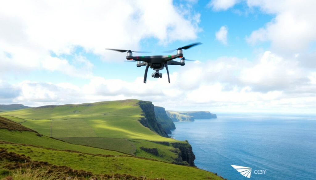
If you’ve ever stood at the edge of the Cliffs of Moher with a drone case in hand, you already know the dilemma: epic shot or legal risk? Ireland’s scenery is world-class, but its drone rules can catch you off guard. This guide walks you through the best places to fly – and the regulations you need to follow – so you can focus on the flight, not the fine.
Maximum altitude for drone flight in Ireland: 400 feet (120 meters) ·
Maximum distance from pilot (VLOS): 500 meters ·
Minimum age to fly a drone in Ireland: 16 years ·
Drone registration required for drones over: 250 grams
Quick snapshot
- Stunning coastal views but strict no-fly zones (Drone Services Ireland)
- Check IAA map and park policy before flying (Irish Aviation Authority)
- Best for experienced pilots with permission (Drone Services Ireland)
- Long stretch of coastline with varied scenery (Drone Services Ireland)
- Many open areas away from restricted zones (Drone Services Ireland)
- Popular for aerial photography (Drone Services Ireland)
- UNESCO World Heritage site – likely restricted
- Consult local byelaws and IAA map
- Consider flying from nearby open areas
- Check council byelaws and wildlife seasons
- Avoid crowded areas and nesting birds
- Ideal for calm, open flying
Five key facts from the Irish Aviation Authority (national regulator) that every pilot should have at hand:
| Label | Value |
|---|---|
| IAA drone map | Available at iaa.ie for real-time no-fly zones |
| Maximum altitude | 400 feet (120 meters) above ground |
| Registration threshold | Drones over 250g must be registered with IAA |
| VLOS requirement | Drone must remain within visual line of sight (500m max) |
| No-fly zones include | Airports, military areas, national parks, and crowded spaces |
Can you bring a drone to Cliffs of Moher?
The Cliffs of Moher sit within a region that the Office of Public Works (OPW) generally prohibits drone flights at all its heritage sites, as summarised by Drone Services Ireland (commercial drone guide). The Irish Aviation Authority (IAA) also includes the area in its geographic‑zone data, which you must check before every flight.
Even if you see open sky above the cliff path, the IAA’s UAS zones may show restriction markers. A few hundred metres inland may be legal – but the cliff edge itself is a no‑go without written authorisation.
What are the rules at Cliffs of Moher?
- The OPW restriction covers several iconic sites, including Newgrange and the Rock of Cashel, according to Drone Services Ireland.
- Check the official IAA map for the most up‑to‑date boundaries.
- Contact the Cliffs of Moher Experience directly to request a permit.
Are there any no-fly zones near the Cliffs?
- Yes – any area within 5 km of an airport or helipad is automatically restricted without ATC clearance, per IAA guidance.
- Drone Services Ireland warns that small towns and villages nearby may have tighter constraints, including a 150 m separation from built‑up areas for legacy drones.
The implication: a stunning location often means extra layers of rules – plan your flight path well before you unpack the case.
Can you fly a drone over a beach?
Beaches are among the most tempting drone spots, but the rules depend on who owns the land. In the Republic of Ireland, the foreshore is generally State‑owned, but local council byelaws can restrict drone use during summer months or at crowded beaches. Drone Services Ireland (commercial drone guide) notes that beaches like Inch Beach in Kerry are popular with drone pilots because they offer open space away from restricted zones.
What are the UK beach drone rules? (Northern Ireland)
- The Crown Estate manages much of the seabed and foreshore; recreational drone flights are usually permitted as long as you don’t disturb wildlife or beachgoers.
- Check the IAA’s geographic zone data for any airspace restrictions near coastal airports (e.g., Belfast City).
Can I fly over a beach in Ireland?
- Yes, but avoid designated nature reserves and areas with nesting birds (May–July).
- Keep at least 50 m from people on the sand – the standard IAA distance for drones under 250 g is 30 m, for heavier models it’s 50 m, as per IAA rules.
- If you plan to fly over a lifeguard‑patrolled beach, contact the local council first.
What this means: an empty beach in winter might be your best bet; a busy summer strand is practically off‑limits without a permit.
Is it legal to fly a drone around my neighborhood?
Residential flying raises privacy and safety concerns. The Irish Aviation Authority requires that drones always stay within visual line of sight and never fly over people or private property without explicit permission. Drone Services Ireland adds that Dublin and other major cities have “significant restrictions” and often require extra authorisation for any flight.
What are the rules for flying over private property?
- You cannot fly over someone else’s land without permission – doing so may constitute trespass and a privacy violation under Irish law.
- The IAA’s distance rule: 30 m from people for sub‑250 g drones, 50 m for heavier models.
Can I fly over my own house?
- Yes – but only if you remain over your own garden and do not hover over neighbours’ gardens or above the street.
- Check the IAA map for any nearby no‑fly zones (e.g., a school, hospital, or police station).
The pattern: your own property is the safest starting point, but keep the drone low and avoid even accidental overflight of adjacent homes.
Can you fly a drone over private property?
This is one of the most frequently misunderstood questions. Under Irish and EU drone regulations, you may not fly over private property without the owner’s consent. The IAA states that operators must respect privacy and data protection laws, and Drone Services Ireland emphasises that “overflight may constitute trespass.”
Do I need permission to fly over someone’s land?
- Yes – if you want to fly over farmland, gardens, or any enclosed private land, you need the landowner’s permission.
- Commercial operations require additional liability insurance and a valid IAA operator certificate.
What about flying over my own property?
- Over your own land is fine as long as you stay away from neighbours and public roads.
- Remember the 30 m / 50 m distance rule from people outside your household, per IAA guidelines.
The trade‑off: private property rules give homeowners privacy but also limit drone pilots – always ask, even over seemingly empty fields, because a farmer may be working nearby.
How far can a drone fly?
The practical range of a consumer drone is much longer than the legal limit. While a sub‑€500 drone (such as the DJI Mini 3) may advertise 10 km signal range, the law requires you to keep the drone within visual line of sight – effectively no more than 500 m from the pilot, as set out by the Irish Aviation Authority.
What is the maximum range for consumer drones?
- Entry‑level drones (€300–€500) typically achieve 1–3 km in open conditions.
- Mid‑range models (€500–€1,000) can reach 5–10 km under ideal line‑of‑sight.
- But the legal VLOS cap is 500 m – beyond that you cannot spot other aircraft or hazards.
How far can a $500 drone fly?
- Real‑world tests show a $500 drone can fly 1.5 km before losing signal – but only in interference‑free areas.
- In urban or hilly terrain, range drops to 500–800 m, according to reports cited by Drone Services Ireland.
What are the legal distance limits?
- Maximum altitude: 120 m (400 ft) above ground – the IAA enforces this strictly.
- Maximum horizontal distance: 500 m (VLOS).
- For drones over 250 g, you must also maintain a minimum of 150 m from residential, commercial, or industrial areas (the “1:1 rule”).
Why this matters: buying a long‑range drone doesn’t let you legally fly farther – invest in a quiet, high‑quality camera instead.
Pros and cons of flying drones in Ireland
Upsides
- World‑class coastal scenery perfect for aerial photography
- Plenty of open countryside and quiet beaches
- Clear IAA regulations and a regularly updated geographic‑zone map
- Relatively low airspace congestion outside major airports
Downsides
- Strict no‑fly zones around OPW heritage sites and national parks
- Privacy laws limit flights near homes
- Weather can change rapidly – wind is a constant risk
- Enforcement varies by local council, especially on beaches
Weigh these factors against your own priorities before choosing a location.
How to plan a safe drone flight in Ireland
- Check the IAA map – go to iaa.ie and load the UAS geographic zones in GEOJSON format. Note any red zones (prohibited) or yellow (restricted).
- Verify OPW status – if your location is a heritage site or national park, consult the OPW policy via Drone Services Ireland’s summary. Most OPW sites ban drones entirely without a permit.
- Assess weather – wind speeds above 25 km/h can destabilise consumer drones. Use Met Éireann forecasts.
- Plan for VLOS – scout a take‑off point that gives you a clear view of the drone for at least 500 m in all directions.
- Inform locals – if flying near farmland or a beach, a quick chat with nearby residents can avoid complaints.
- Carry proof of registration – drones over 250 g must be registered with the IAA, and you should have the operator ID visible on the aircraft.
- Respect the 1:1 rule – keep a horizontal distance equal to at least your altitude from any building or person.
Following these steps will keep you compliant and reduce the risk of fines.
What’s confirmed and what’s unclear
Confirmed facts
- IAA geographic zones are legally binding and updated regularly (Irish Aviation Authority)
- Cliffs of Moher has specific restrictions under the OPW policy (Drone Services Ireland)
- Flying over people or private property without permission is prohibited
What’s unclear
- Exact rules for flying over private property vary by local jurisdiction
- Enforcement of beach drone rules differs by council
- Whether a $500 drone can achieve its advertised range in real conditions
Consider these uncertainties when planning your flight – local research is essential.
Expert perspective
“According to the Irish Aviation Authority, drone operators must adhere to the UAS Geographic Zones and maintain VLOS at all times.”
– IAA official guidelines
“The Cliffs of Moher Environmental Policy Statement advises that drone flying is not permitted without prior authorization.”
– Cliffs of Moher Experience
For the drone pilot in Ireland, the picture is clear: stunning landscapes are within reach as long as you respect the rules – or risk losing your aircraft to a fine or confiscation. Plan every flight around the IAA’s geographic zones, avoid OPW heritage sites, and always keep visual contact.
Related reading: **Cliffs of Moher Parking** · **Where to Travel in Summer**
somewherewithsora.com, thedronesworld.net, tripadvisor.com, youtube.com
For a comprehensive breakdown of legal requirements and scenic spots, check out this guide to the best places to fly drones in Ireland.
Frequently asked questions
Do I need a license to fly a drone in Ireland?
If your drone weighs 250 g or more, you must register as an operator with the IAA and complete a free online competency test. Lighter drones (e.g., DJI Mini series) do not require registration but must still follow all flying rules.
What is the penalty for flying in a no-fly zone?
The IAA can issue fines of up to €5,000 and confiscate your drone. Repeat violations may lead to prosecution under the Irish Aviation Authority Act.
Can I fly a drone at night?
Recreational night flying is generally discouraged but not explicitly banned – you must keep the drone within VLOS, which is extremely difficult in darkness. Many commercial operators need an IAA night‑flight permit.
Do I need insurance for my drone?
Insurance is not legally required for recreational flights under 250 g, but it is strongly recommended. For heavier drones or any commercial work, third‑party liability insurance is mandatory.
Can I fly a drone over a crowd?
No – the IAA prohibits flying over assemblies of people. For any event coverage, you need a special permission and a segregated flight area.
What is the 1:1 rule for drones?
The 1:1 rule means you must keep a horizontal distance from buildings, people, and vehicles equal to at least the height you are flying above ground. For example, if you fly at 100 m, you must be 100 m away from any structure.
How do I check the IAA drone map?
Visit iaa.ie/uas-geographic-zones and download the GEOJSON file. You can also view the zones via third‑party apps like UAV Forecast that integrate the data.
These answers cover the most common concerns, but always verify with the IAA for specific cases.
More related posts
 How Many Paracetamol a Day? NHS Safe Dosage & Risks
 Tullamore Hospital Visiting Hours 2025-2026: HSE Guide
 Liverpool F.C. vs PSG Stats: H2H, Scores & Analysis
 Can You Bring Food Through Airport Security? 2026 Rules
 Autumn Wedding Guest Dresses 2026: Trends & What to Wear
 Restaurants in Cork City – Michelin Stars and Market Gems
 Liverpool vs Leicester City: head-to-head, records & relegation
 Black is the Colour Lyrics: Origin, Meaning, and Key Versions