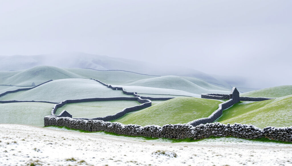
Ireland Winter Forecast Snow – 2024/25 Met Éireann Review
Ireland experienced a predominantly mild winter during the 2024/25 season, though notable cold snaps and snowfall events tested the nation’s preparedness. Met Éireann recorded an average national temperature of 6.73°C, marking the 15th warmest winter since records began in 1900. Despite the overall milder pattern, specific weather events brought significant snow accumulations to various regions, particularly during January.
The season unfolded with an early Arctic intrusion in late November, followed by a notably cold January weekend that prompted orange weather warnings across southern counties. Understanding the factors that influence snowfall in Ireland requires examining how Atlantic weather systems interact with cold continental air masses, a dynamic that shapes the nation’s winter forecasting challenges.
Will it snow in Ireland this winter?
The question of whether Ireland will see snow each winter cannot be answered with a simple yes or no, as snowfall depends on the precise meeting of moisture and cold air. Winter 2024/25 demonstrated this variability clearly, with the season ranking as the 41st driest since 1940 at just 95% of the long-term average rainfall. Despite the drier conditions overall, specific cold snaps delivered measurable snowfall to several regions.
Snow in Ireland requires both sub-zero temperatures at ground level and sufficient atmospheric moisture. When Arctic air moves over the relatively warm Atlantic waters, the resulting instability can produce snow showers, particularly along eastern and northern coasts where cold air interacts with relatively mild sea temperatures.
Overview of the 2024/25 Winter Season
Low to moderate (20-40%)
January to February
Lows reaching -5°C
Arctic air inflows
Key Findings from Winter 2024/25
- The national average temperature of 6.73°C exceeded the 1991-2020 baseline by 0.73°C, reflecting a generally mild pattern
- December and February recorded above-average temperatures at all monitoring stations
- January proved considerably colder due to an early Arctic airmass affecting the country
- Total precipitation reached only 95% of the long-term average, making it the 41st driest winter since 1940
- Regional snowfall varied significantly, with southern and western areas receiving heavier accumulations than eastern coasts during January events
- Met Éireann issued targeted snow warnings rather than broad seasonal predictions, focusing on specific cold snap events
- No long-range snow probability percentages were published in official forecasts
Season Snapshot
| Metric | Winter 2024/25 | Historical Average |
|---|---|---|
| National Temperature | 6.73°C | 6.00°C |
| Temperature Anomaly | +0.73°C above average | Baseline period 1991-2020 |
| Rainfall | 95% of average | 100% (1991-2020) |
| Season Rank | 15th warmest since 1900 | 125+ years of records |
| Dryness Ranking | 41st driest since 1940 | 84+ years of records |
| January Temperature | Below average | Variable |
What is the latest Ireland winter snow forecast from Met Éireann?
Met Éireann, Ireland’s national meteorological service, takes a cautious approach to seasonal snow forecasting. Rather than issuing broad percentage probabilities for snowfall, the service focuses on targeted warnings when specific cold events approach. This methodology reflects the inherent unpredictability of snow in Ireland’s maritime climate, where small differences in temperature or precipitation path can dramatically alter outcomes.
During winter 2024/25, Met Éireann issued advisories highlighting “significant” accumulations of 5 centimetres or more and “impactful” snowfall during confirmed cold snaps. These warnings came with appropriate lead times, allowing communities to prepare for hazardous conditions. The service emphasized event-specific risks rather than season-wide predictions, acknowledging that long-range forecasts cannot reliably pinpoint snow occurrence weeks in advance.
How Does the UK Met Office Compare to Ireland’s Forecasts?
Direct comparisons between UK Met Office and Met Éireann winter snow forecasts for Ireland are limited in the available documentation. Both services operate within the same North Atlantic weather system, meaning their forecasts often converge on major patterns. However, Ireland’s position slightly further west and its exposure to Atlantic moisture tracks can produce different outcomes from UK-focused predictions.
UK-named storms that affected Ireland during winter 2024/25, including Storm Éowyn on January 24 and Storm Darragh in early December, brought extreme winds and disruptions. These systems interacted with cold air masses, creating snow potential in some regions, though their primary impact remained strong winds and rainfall rather than widespread snowfall.
Met Éireann’s extended range forecasts were available throughout the season but provided no specific snow predictions for winter 2024/25. The service prioritizes accuracy over detailed speculation when confidence levels are low.
When and where is snow expected in Ireland this winter?
Timing represents perhaps the most challenging aspect of winter snow forecasting for Ireland. Historical data and winter 2024/25 observations confirm that January and February carry the highest probability of significant snowfall, though exceptions occur regularly. The season’s first meaningful cold snap typically arrives in November, as demonstrated in late 2024, with further events distributed through the coldest months.
November 18-22, 2024: First Major Cold Snap
Met Éireann issued a rare nationwide advisory on November 15, 2024, as Arctic air began moving across Ireland. Daytime temperatures fell to between 2°C and 6°C, while night-time temperatures dropped below freezing across the country. Widespread frost and ice formed on untreated surfaces, with sleet and snow showers affecting northern areas, particularly Ulster.
Hazardous travel conditions persisted until at least November 22 as the cold spell held firm. While accumulations remained modest compared to later events, the early-season nature of this snap caught many by surprise, demonstrating how quickly conditions can change when Arctic air reaches Irish latitudes.
January 4-5, 2025: Wintry Weekend Event
The most significant snowfall of the season occurred during the first weekend of January 2025. Met Éireann issued orange snow and ice warnings covering Munster and south Leinster, forecasting accumulations exceeding 5 centimetres within 24 hours in some locations. The warning highlighted how Atlantic rain meeting cold Arctic air creates ideal conditions for snowfall in southern counties.
Yellow warnings covered remaining areas, predicting between 1 and 5 centimetres depending on location and elevation. Forecasters warned of drifting snow, poor visibility, and travel disruptions, with the cold conditions expected to persist well into the following week.
Regional Distribution of Snowfall
The January 4-5 event produced heavy snowfall across the south Midlands, South, Southwest, and West of the country, with accumulations lingering for days in some areas. Dublin, situated in Leinster, fell within the yellow warning zone with potential for impactful accumulations under the orange warning boundaries.
Northern areas, including Ulster, saw snow showers during the November cold snap but received less during the January event than southern and western regions. This pattern reflects how Atlantic moisture interacting with cold continental air produces heavier snowfall in southern exposed areas.
December saw lying snow in some locations during cooler, wetter periods, but high pressure dominating much of the month created milder, drier conditions overall. This variability highlights how regional topography and exposure dramatically influence local snowfall amounts even within short distances.
What factors influence Ireland’s winter snow chances?
Several interconnected factors determine whether Ireland experiences significant snowfall during any given winter. Understanding these elements helps explain why the island’s weather can vary dramatically from year to year and even week to week during the cold season.
Arctic Air Inflows
The primary driver of Irish snowfall remains the arrival of Arctic air masses. When high pressure establishes itself over Scandinavia or the continent, it funnels cold air westward across the Irish Sea and into Ireland. These inflows can arrive rapidly, transforming mild conditions to sub-zero temperatures within 24 to 48 hours.
Winter 2024/25 demonstrated this pattern clearly when an early Arctic airmass arrived in November and another affected the country during January. The January event proved particularly significant because the cold air remained in place long enough for Atlantic moisture to fall as snow rather than rain.
Atlantic Low Pressure Systems
Ireland’s position on the western edge of Europe means Atlantic weather systems frequently influence conditions. These low-pressure areas bring moisture but also milder air from the ocean. The critical factor for snow lies in whether cold Arctic air remains in place when moisture arrives.
Storms such as Éowyn and Darragh demonstrated this interplay during winter 2024/25. While their primary impacts involved extreme winds, their interaction with cold air created secondary snow risks in affected regions.
Jet Stream Position
The position and strength of the jet stream, a high-altitude wind current flowing from west to east, strongly influences which weather patterns reach Ireland. When the jet stream dips southward, it allows Arctic air to penetrate further south and brings storm systems across the Atlantic. Conversely, a northward position tends to bring milder, more settled conditions.
Sea Surface Temperature Effects
The relatively warm waters surrounding Ireland (compared to continental Europe at similar latitudes) introduce an element of instability when cold air passes overhead. This temperature contrast can generate snow showers, particularly along eastern and northern coasts where the air has spent longer over open water.
La Niña and Other Climate Patterns
Met Éireann’s analyses for winter 2024/25 made no mention of La Niña conditions influencing Irish weather patterns. The climate phenomenon, characterized by cooler-than-normal Pacific waters, can affect global weather patterns but was not identified as a significant factor in Ireland’s winter conditions.
How does this winter compare to past snowy seasons in Ireland?
Placing winter 2024/25 within the context of historical records reveals both its moderate character and the variability that defines Irish winters. The season ranked as the 15th warmest since 1900, reflecting a broader trend toward milder winters in recent decades while acknowledging that significant cold events still occur. For those interested in vehicle specifics, the Hyundai Santa Fe 2025 Ireland price is available. Hyundai Santa Fe 2025 Ireland price
Temperature Comparison
The warmest winter on record occurred in 2019 with an average temperature of 7.48°C, while the coldest was 1963 at just 2.90°C. Winter 2024/25’s 6.73°C average sits comfortably between these extremes, closer to the warmer end of the spectrum but still capable of producing notable cold spells.
December and February both recorded above-average temperatures at all stations, contributing significantly to the mild overall season. January’s cooler performance, driven by Arctic air inflows, provided the most wintry conditions of the season.
Precipitation Comparison
The driest winter since 1940 occurred in 1964, while 2016 holds the record for the wettest. Winter 2024/25’s rainfall of 95% of average places it firmly in the drier-than-normal category, though far from record territory. This reduced moisture availability may have limited overall snowfall amounts despite the cold January conditions.
Recent Winter Trends
Historical data accessed through Met Éireann’s portal shows that winter 2024/25 aligns with recent milder trends while still producing events like those seen in January. Dublin and the wider Leinster region experienced the typical pattern of being exposed to snow risks during cold snaps but overall benefiting from the maritime influence that moderates extreme conditions.
While no two winters are identical, Met Éireann’s historical records provide essential context for understanding what constitutes normal variability versus unusual conditions. The service maintains comprehensive data going back over a century.
Timeline of Winter 2024/25 Snow Events
The season unfolded across several distinct phases, with cold weather punctuating an otherwise mild winter. Understanding this progression helps contextualize the snowfall patterns that affected different regions at different times.
- November 18-22, 2024: First major cold snap of the season brings Arctic air across Ireland. Met Éireann issues rare nationwide advisory. Daytime temperatures fall to 2-6°C. Snow showers affect northern areas, particularly Ulster. Hazardous travel conditions persist for several days.
- Early December 2024: High pressure dominates, bringing milder and drier conditions overall. Storm Darragh passes through on December 6, bringing extreme winds and some interaction with cold air. Lying snow appears in places during cooler periods but does not persist.
- Late December 2024: Above-average temperatures continue through most of the month. Occasional cooler spells bring brief wintry conditions but no significant accumulations.
- January 4-5, 2025: Major wintry event brings heaviest snowfall of the season. Orange warnings issued for Munster and south Leinster with 5+ cm accumulations expected. Yellow warnings cover remaining areas. Heavy snowfall reported in south Midlands, South, Southwest, and West. Snow lingers for days in some locations.
- January 24, 2025: Storm Éowyn brings extreme winds to Ireland. Interaction with cold air creates secondary snow risks in affected regions, though primary impacts involve wind damage and travel disruption.
- February 2025: Temperatures rise above average again, bringing a return to milder conditions. Some residual cold spells occur but no significant snowfall events recorded during the month.
What is certain and what remains uncertain about Ireland’s winter snow?
Any discussion of winter snow in Ireland must acknowledge both what can be determined with reasonable confidence and what remains genuinely uncertain. This distinction helps readers understand the limitations of current forecasting capabilities while appreciating the factors that do influence outcomes.
| Established Information | Information That Remains Unclear |
|---|---|
| Arctic air inflows bring the highest snow risk to Ireland | Precise probability percentages for snowfall in specific regions |
| January and February typically carry the highest snow risk | Exact timing and duration of future cold snaps |
| Met Éireann issues targeted warnings rather than seasonal predictions | How climate change will affect winter snowfall long-term |
| Atlantic systems interacting with cold air produce snowfall | Whether La Niña or other climate patterns will influence upcoming winters |
| Regional topography significantly affects local snowfall amounts | Detailed comparative model outputs from different forecasting centers |
Understanding Ireland’s winter weather patterns
Ireland’s position in the North Atlantic creates a climate that defies simple categorization. The island sits at a latitude that would suggest cold winters, yet the surrounding ocean moderates temperatures significantly. This maritime influence means that even during Arctic outbreaks, coastal areas rarely experience the prolonged severe cold seen in continental Europe.
The interplay between mild Atlantic air and cold continental outflows defines Ireland’s winter character. When cold air remains in place as Atlantic moisture arrives, the conditions for significant snowfall exist. When milder air dominates, as it did for much of December 2024, precipitation falls as rain even when temperatures hover near freezing.
Climate monitoring through Irish climate publications shows that while individual winter snowfall events still occur, the overall trend in recent decades has been toward milder conditions. This does not eliminate the possibility of significant snowfall in any given year, as winter 2024/25 demonstrated, but it does suggest that such events may become less frequent over time.
Sources and official information
The most authoritative source for Irish weather information remains Met Éireann, whose climate statement for winter 2024/25 provides comprehensive data on temperature, precipitation, and significant weather events throughout the season. This official record confirms the season’s mild character while documenting the notable cold snaps and snowfall that did occur.
Met Éireann’s climate statement confirms that winter 2024/25 ranked as the 15th warmest since 1900, with an average national temperature of 6.73°C, despite some cold snaps and snow events.
Additional sources consulted include meteorological commentary on the January 4-5 wintry conditions, which provided specific details on warning levels and expected accumulations, as well as the annual climate statement for 2024 placing the winter within the broader annual context.
International forecasting centers such as the European Centre for Medium-Range Weather Forecasts provide model outputs that inform national forecasting services, though specific comparative predictions for Ireland were not detailed in available documentation.
Summary: Ireland winter snow forecast 2024/25
Winter 2024/25 in Ireland proved to be predominantly mild, ranking as the 15th warmest since 1900, with an average national temperature of 6.73°C. However, the season delivered notable snowfall events, particularly during a significant January cold snap that brought orange weather warnings to southern counties and measurable accumulations across multiple regions. Met Éireann’s approach of issuing targeted warnings for specific cold events rather than broad seasonal predictions reflects the genuine uncertainty inherent in forecasting snow for Ireland’s maritime climate. For those interested in how Ireland’s climate compares to other extreme weather phenomena, the Ireland Extreme Heat Weather Forecast provides additional context on seasonal variations.
Frequently Asked Questions
What are the chances of heavy snow in Ireland?
Heavy snow in Ireland requires both sub-zero temperatures and sufficient moisture arriving simultaneously. While winter 2024/25 demonstrated that significant accumulations can occur during January cold snaps, Met Éireann does not publish specific probability percentages for heavy snowfall. The likelihood varies significantly by region and depends on the interaction between Arctic air and Atlantic moisture.
How does the UK Met Office forecast compare to Ireland’s predictions?
Both services operate within the same North Atlantic weather system and often agree on major patterns. However, Ireland’s position further west and greater exposure to Atlantic moisture can produce different outcomes from UK-focused predictions. Direct comparative forecasts for Ireland from both services were not detailed in available documentation.
What influences Ireland’s winter weather patterns?
Multiple factors influence Ireland’s winter weather, including Arctic air inflows, Atlantic low-pressure systems, jet stream position, and sea surface temperature effects. The interaction between cold continental air and mild Atlantic moisture determines whether precipitation falls as rain, sleet, or snow. La Niña was not identified as a significant factor for winter 2024/25.
Has it snowed heavily in Ireland in recent winters?
Recent winters have generally trended milder, though winter 2024/25 demonstrated that significant snowfall events still occur. The January 4-5, 2025 event brought the heaviest accumulations of the season, with orange warnings issued for Munster and south Leinster. Historical data shows considerable variation between years, with some winters producing minimal snow while others see notable accumulations.
What was the Dublin winter snow forecast for 2024/25?
Dublin, situated in Leinster, fell within yellow and orange warning zones during the January 4-5 snow event, with potential for impactful accumulations depending on the precise track of the moisture-bearing system. Overall, Dublin experienced mild conditions for much of the season but faced genuine snow risks during the January cold snap, consistent with the city’s exposure to Leinster weather patterns.
How accurate are long-range snow forecasts for Ireland?
Met Éireann’s extended range forecasts did not provide specific snow predictions for winter 2024/25. The service focuses on targeted warnings when cold events approach rather than issuing seasonal probabilities. This reflects the genuine difficulty of predicting snowfall weeks in advance, given the precise temperature and moisture conditions required.
Where in Ireland is snow most likely?
Winter 2024/25 saw the heaviest snowfall in southern and western areas during the January event, while the November cold snap affected northern regions more significantly. Regional topography plays a crucial role, with higher elevations and exposed areas receiving more accumulation. Coastal regions may see snow showers even when inland areas remain clear.
More related posts
 How Many Paracetamol a Day? NHS Safe Dosage & Risks
 iPhone 16 Pro Max Case: Best Ireland Options
 Can You Bring Food Through Airport Security? 2026 Rules
 Best Places to Fly Drones in Ireland: Legal Spots & Rules
 Leeds United vs West Ham Stats – Head-to-Head Record, Wins, Goals & History
 Super Mario 3D World: Levels, Difficulty & Co-Op Guide
 Houses for Sale in Claremorris – Listings, Prices & Guide
 Best Locro de Zapallo Near Me: Authentic Peruvian Pumpkin Stew